The border at Oyster Pond, the reason behind another conflict
For decades, the French side and the Dutch side have been fighting over Oyster Pond border. It has not been officially demarcated, or at least approved by both parties, which is at the origin of many diplomatic discords. The last disagreement occurred last week.
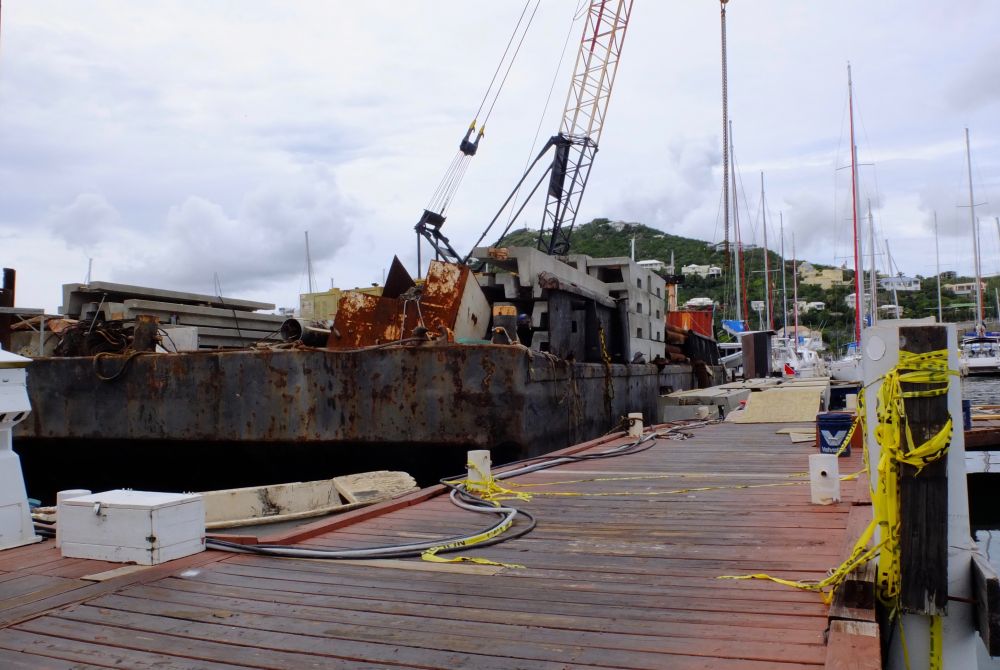
On Wednesday October 26, the French authorities went to Oyster Pond to go inspect a construction site on the water. It had been reported that a pontoon was being built without permission. Therefore, they had to check if the site and the workers were legally declared. After examination, the construction site was found to be illegal and some workers had not been declared.
However, these inspections took place on a pontoon, meaning above the water. However, according to the Dutch, the sea belongs to Sint Maarten and the land to Saint-Martin, since the border passes at the coastline. They concluded that the French authorities conducted an inspection on their territory. The Prime Minister, William Marlin, who is on a trip in Miami, was informed. It’s almost a diplomatic incident.
We then contacted the Prefecture which confirmed what had happened (inspection of a non-authorized construction site and discovery of undeclared persons) but they remained silent on the consequences.
A week later, William Marlin decided to react. He spoke through the newspapers on Tuesday November 1, as our Dutch colleagues have reported in today’s edition of their newspaper. The Prime Minister spoke about the request he sent to the Prefect Anne Laubies in which he asked her to "remove the barricades which have been set up in Oyster Pond". In case of non-compliance, Sint Maarten reserves the right to remove them itself.
"As the Prime Minister of Sint Maarten, I strongly condemn the French authorities’ actions and consider these acts by the French Republic as aggressive and illegal acts which undermine Sint Maarten’s authority and violate its rights", said the Prime Minister to the Prefect.
It seems that William Marlin somewhat exaggerated when he used the term "barricades". There are not any barriers per se but a "caution" tape for demarcating the site and to protect the public.
In Oyster Pond, the stakes are high and also of a financial nature. Demarcating the border comes down to specifying the location of Captain' Oliver. In other words, it means determining to whom the famous complex must pay its taxes. Currently, it is paying them to Sint Maarten.
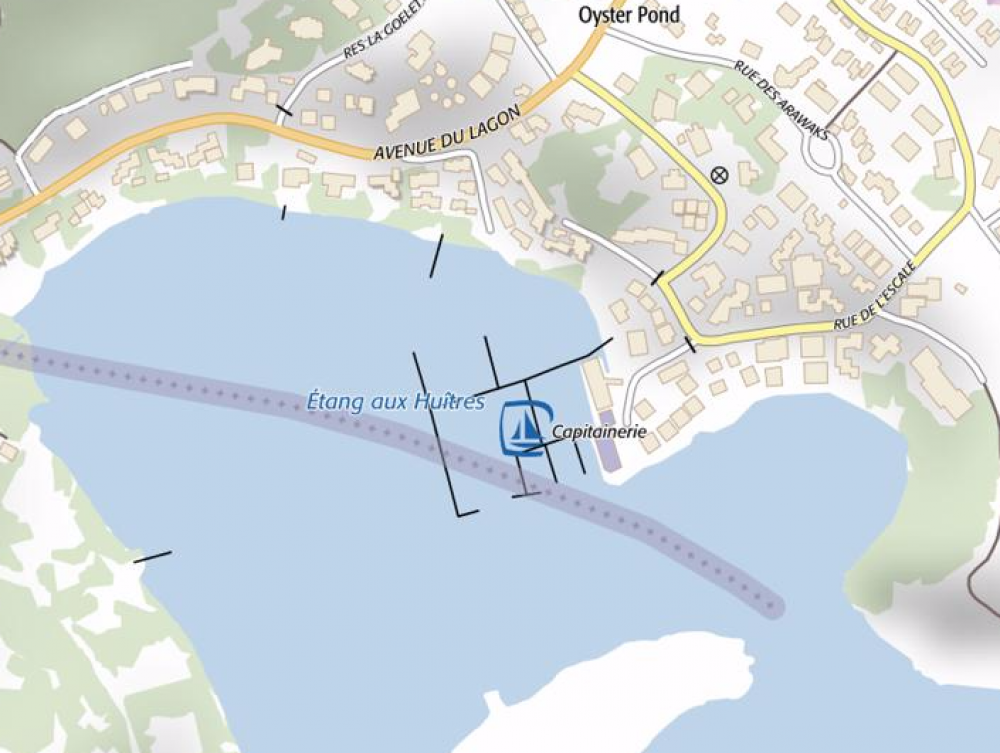
It is interesting to note that according to the maps, the border does not pass at the same location. If we look at the tourist maps, it runs along the coastline. If we look at the IGN website (National Geographical Institute), it passes in the middle of the bay and part of the sea belongs to France.
And if we refer to the United Nations Convention on the Law of the Seas of December 10, 1982, specifically to its article which stipulates the determination of the territorial sea between States with opposite or adjacent coasts - which is the case at Oyster Pond, “neither of the two States is entitled, failing agreement between them to the contrary, to extend its territorial sea beyond the median line every point of which is equidistant from the nearest points on the baselines from which the breadth of the territorial seas of each of the two States is measured”.
At ten days from the celebration of Sint Maarten Day on November 11, the atmosphere looks tense.


Comments
a great food service range
a great food service range including some of the most well-known brands in the hospitality industry, then Weststate Seafoods is the company for you.sea food Wholesale